코스 소개
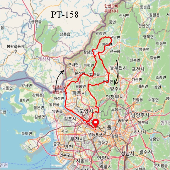
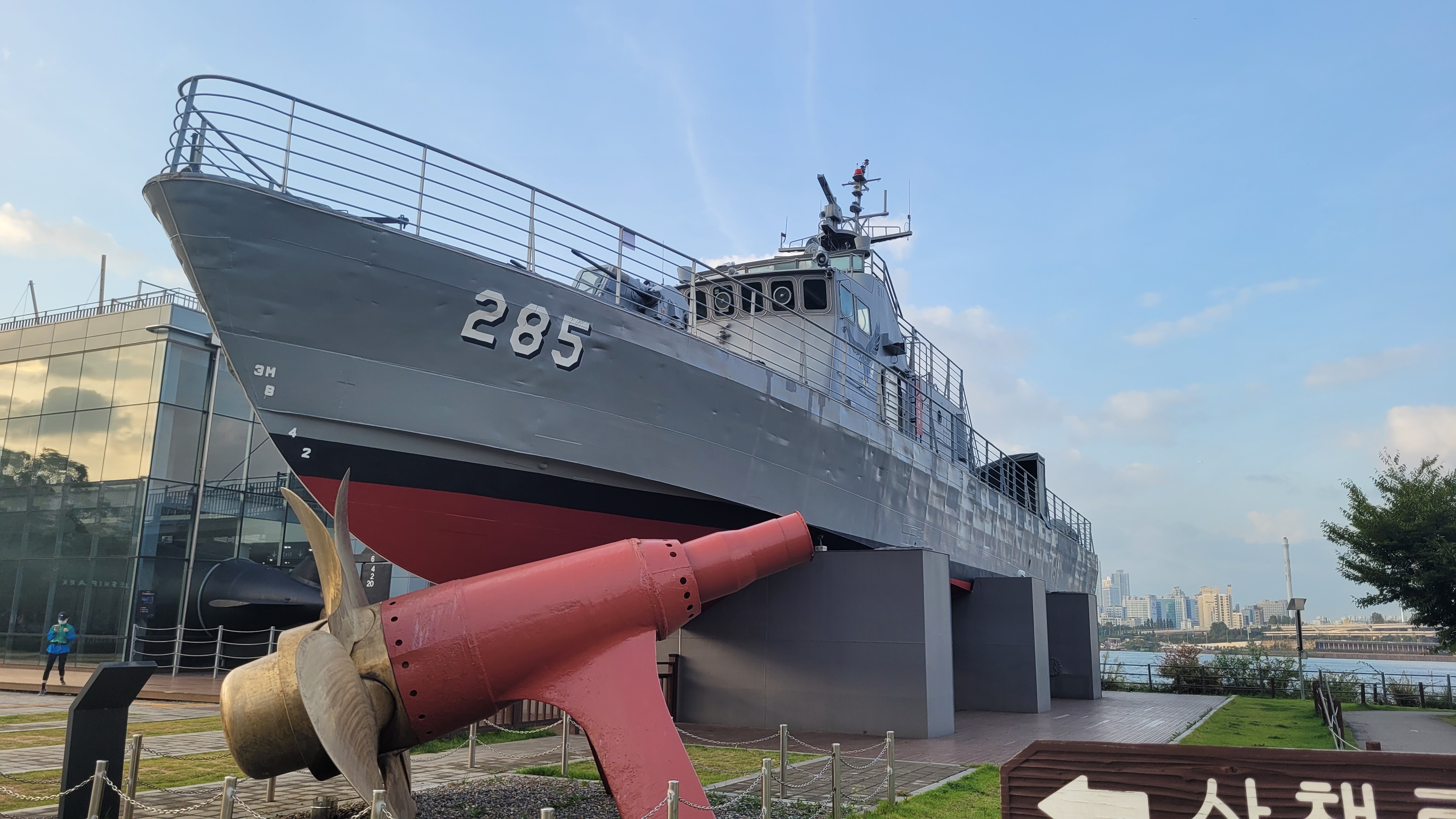
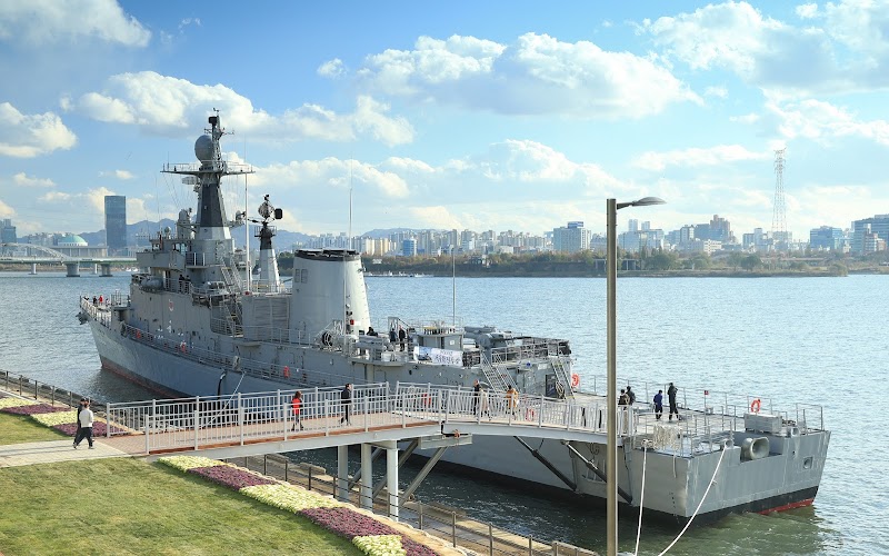
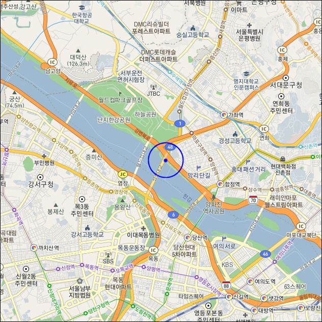
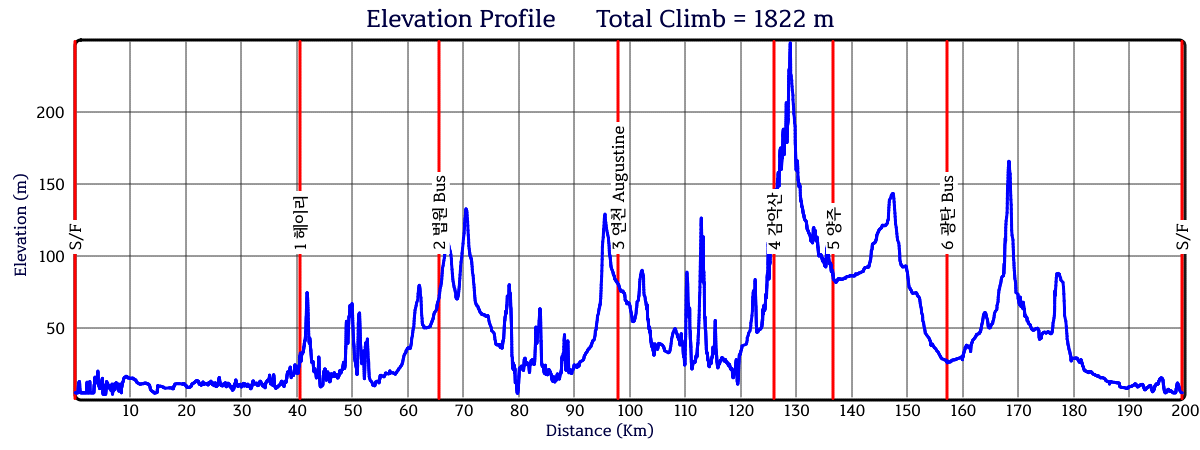
이 코스는 한강자전거 도로상에 있는 성산대교 옆 서울함 공원을 출발하여 서울 서북쪽의 평화누리 자전거도로를 달릴 수 있다. 한민족분단의 아픔을 역사적으로 상징하는 임진각으로 달릴 수 있는 자전거도로이며 코스중간에 임진강 너머의 북한을 볼 수 있는 오두산 통일동산 전망대를 지나간다. 헤이리 통일동산 관광지와 문산역을 지나 북쪽으로 계속 달리면 DMZ에 인접한 호젓하고 공기좋은 도로를 달릴 수 있다. 파주의 대표적 관광지인 감악산 흔들다리를 지나 혜음령 및 삼송지역을 통과하면 창릉천 자전거도로에 진입한다. 작은 하천에 자전거 도로를 만든 창릉천를 열심히 달리다 보면 이윽고 한강에 도착한다. 이어서 아름다운 갈대숲 사이로 계속 라이딩하면 한강의 아름다움에 매료되고 새로운 즐거움을 느낄 수 있다.
course description
This course departs from the Seoul Ham Park next to Seongsan Bridge on the Hangang Bicycle Road and runs on the Pyeonghwa Nuri Bicycle Road in the northwest of Seoul. It is a bicycle path that can run to Imjingak Pavilion, which historically symbolizes the pain of the division of the Korean people, and passes through the Odusan Unification Garden Observatory, where you can see North Korea beyond the Imjingang River. When you continue to run north after passing Heyri Unification Garden Tourist Site and Munsan Station, you can run on a quiet and airy road adjacent to the DMZ. When you pass through the Haenggari Bridge of Gamaksan Mountain, a representative tourist destination in Paju, and pass through Hyeumryeong Pass and Samsong area, you will enter the Changneungcheon Bicycle Road. When you drive hard through Changneungcheon Stream, which has built a bicycle path in a small river, you will soon arrive at the Han River. Subsequently, When you continue to ride through the beautiful reed forest, you can be fascinated by the beauty of the Han River and feel a new pleasure.