퍼머넌트 PT-13 | Permanent PT-13
PT-13 울진의 언덕과 시내 Hills and Streams of Uljin
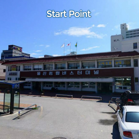
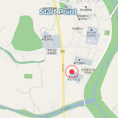
출발/완주점 Start/Finish
울진버스터미널
Uljin Bus Terminal
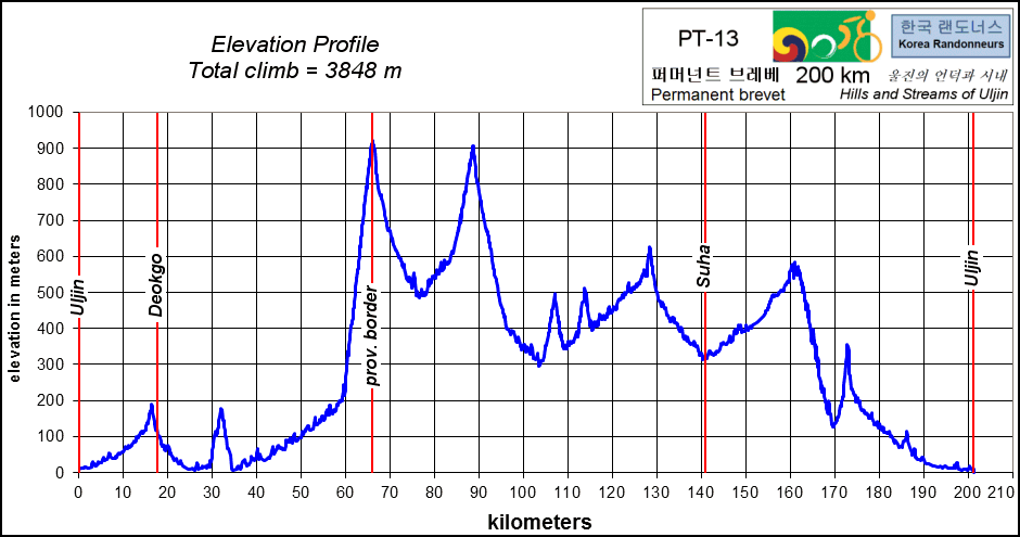
PT-13 퍼머넌트는 좁고 가파른 시골길을 가야 하기 때문에 160km에서 180km정도의 거리를 해가 있을 때 끝낼 수 있도록 계획을 세워야 합니다. 이 214km 브레베는 오르막과 외진 시골길 라이딩을 즐기는 참가자들을 위해 만들어 졌습니다. 산 속의 작은 시내들과 들판을 지나서 해발 900m 넘어 까지 가게 됩니다. 대부분의 길들은 고립되어 있으니 충분한 음식과 마실 것 그리고 여분의 자전거 부품을 챙겨 가셔야 합니다.
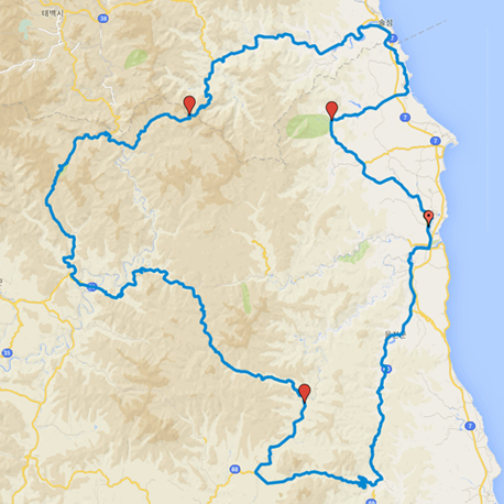
이 코스는 울진 버스터미널에서 시작해서 917번 도로로 들어가서 남대강을 따라갑니다. 강을 벗어나 북쪽으로 방향을 틀면 첫 번째 포토 컨트롤에 도착합니다. 또 다른 강이 동해로 인도하고 북구를 통과합니다. 해안선을 따라 10km 북쪽으로 달리다가 서쪽으로 틀어 산으로 들어갑니다. 416번 도로로 강을 따라서 가다가 이 코스의 힘든 부분의 시작인 20km 언덕을 천천히 올라가십시오. 약 57km 지점에서 왼쪽으로 틀어서 910번 도로로 진입 해발 911m의 10km 클라임을 하십시오. 10km의 내리막을 즐기시고 500m 고도에 내리막 후에는 소천면에 있는 36번 도로로 합류합니다. 120km 지점에서 오른쪽으로 돌아서 917번 도로로 가십시오. 다음 컨트롤은 141km지점 이 도로에 있습니다. 수비면에서 왼쪽으로 돌아서 88번 도로로 가십시오. 조심해서 가파른 내리막을 69번 도로 쪽으로 내려오십시오. 왼쪽으로 돌아서 69번 도로로 가서 북쪽으로 가십시오. 이제 울진으로 돌아옵니다.
경고 400m 정도의 자갈밭 길이 170km 지점에 있습니다. 조심해서 지나서 포장도로로 다시 합류 하십시오. 69번 도로가 다시 매화리로 인도합니다. 10km을 더 타면 울진 버스터미널이 나옵니다.
**For your safety, please plan your schedule to be able to do kilometer 160 to kilometer 180 in daylight. Narrow, steep country roads** This 201.4 km randonnee is designed for those who love to climb and ride on remote country roads. It will take you along small mountain streams, through the fields and up to over 900m. Many of these roads are quite isolated, so make sure you have lots of drinks, food, and spare parts.
Starting from Uljin bus station, the course will join road 917 and follow the Namdae River. After turning north away from the river you will come to the first photo control point. Another river will lead you back to the East Sea and through Buk-gu. The course heads north along the coast for about 10 km, before turning west into the mountains. Follow road 416 along the river and climb gently for about 20 km, at which point the hard work begins! Take a left on to road 910 around kilometer 57 and then climb for 10 km up to a height of 911 m. Enjoy 10 km of descent down to 500 m and the next checkpoint, before climbing back up to 900 m next to Cheongoksan National Forest. Descend from the pass to join road 36 in Socheon-myeon. Around kilometer 120, take a right onto road 917. The next checkpoint is on this road around kilometer 141. Turning left onto road 88 in Subi-myeon, descend carefully down the steep road to road 69. Turn left onto 69 and go north, back towards Uljin.
**CAUTION - There is a 400 m section of gravel road around kilometer 170, cross this carefully and rejoin the paved road after 400 m** Road 69 will take you back to Maehwa-ri, and the course finishes 10 km later at Uljin bus station.